

The new layout of the Flaminia way may well be something we’re accustomed to by now. Nonetheless, historical prints and postcards held in the Palazzo Mauri photo library help us evoke the landscape at the southern entrance to the city as it looked at the time.
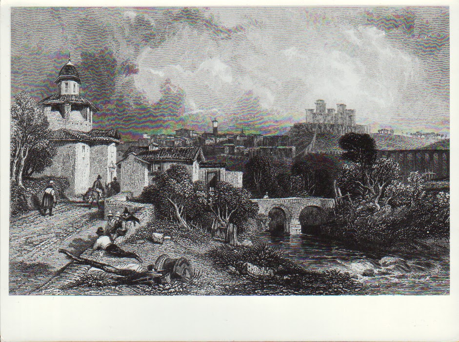
The bridge which crossed the Tessino stream and connected the town with Monteluco, and the church of San Rocco, with its unmistakable dome, stand out.
A monument of great interest and fine workmanship, the unfinished church was built in 1488 and would only take the name of San Rocco at the end of the 18th century after a small church that stood nearby, later pulled down; before that, it was actually called the Church of Santa Maria del Massaccio.
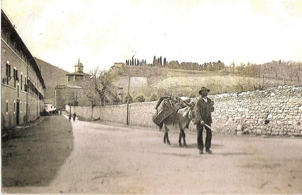
The name is possibly explained by the large Roman ruins in the area, today’s Via San Carlo. The area, with its numerous remains of ancient Roman buildings, follows the route of the ancient Via Flaminia, which entered the city from the south through Porta Monterone, also known as Porta Romana.
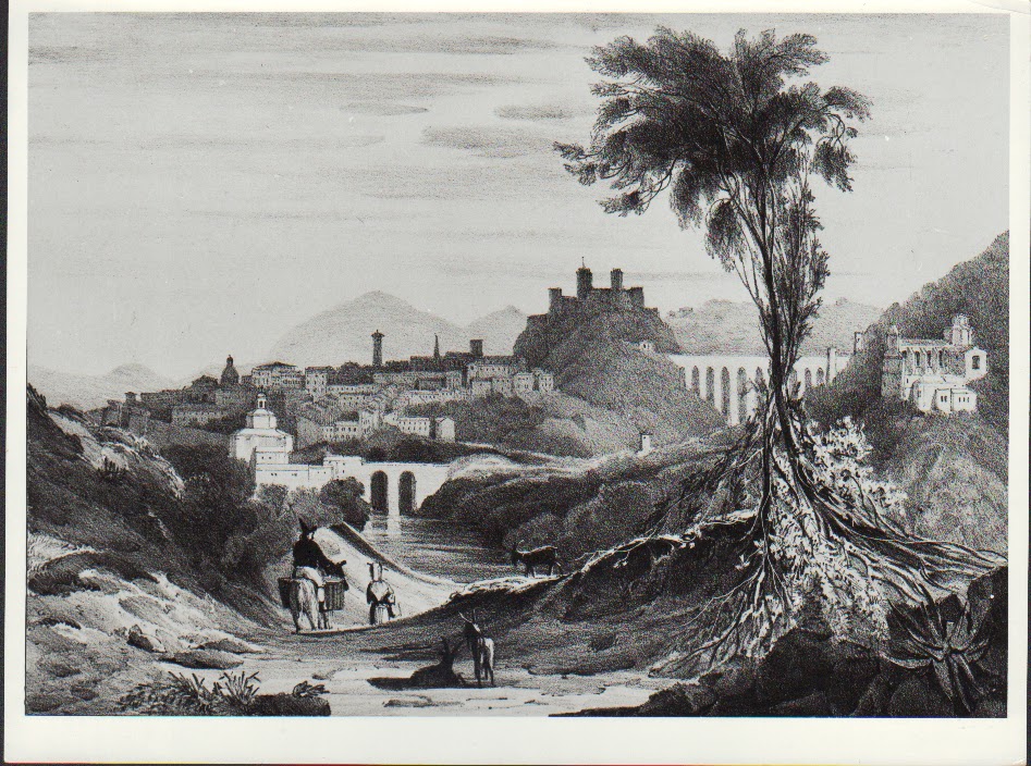
The harmony of the scenery in the old postcards is striking. “The surrounding landscape – according to the authors of L’Umbria, Manuali per il Territorio of 1978 – has been completely transformed by the variant of the Via Flaminia, which has broken the existing natural continuity between the course of the Tessino and the slopes of Monteluco; the wide asphalt straightaway, which continues in tunnels under Colle S. Elia and the intense, fast traffic that takes place there cannot assimilate with the widely modulated lines of the landscape and its quiet solemnity”.
News Archive
- The Royal Experimental Oil Mill | 29 October 2021
- Alberto Talegalli | 22 October 2021
- When the Giro della Rocca did not exist yet | 15 October 2021
- 1893, stage magic at the Teatro Nuovo | 8 October 2021
- Houses of Historical Spoletan Families | 1 October 2021
- April 1906. Inauguration of the plaque to Carducci | 31 August 2021
- 1891: Sordini digs out the Roman Theatre | 27 August 2021
- Piazza Campello before 1910 | 6 August 2021
- Il Ponte Sanguinario | 30 July 2021
- The new tunnel under the Rocca | 23 July 2021
- 1940, the dukes of Spoleto visit the new hospital | 16 July 2021
- Signature sketches at the Festival of Two Worlds (2) | 9 July 2021
- Signature sketches at the Festival of Two Worlds | 2 July 2021
- Unesco Decade for the Basilica of San Salvatore | 25 June 2021
- 18 May 1979, the city tributes Thomas Schippers | 18 June 2021
- The Road to Monteluco | 11 June 2021
- Carla Fracci, Grand Dame of Italian Ballet | 4 June 2021
- The city’s electrical system comes into operation | 28 May 2021
- The Spoleto-Forca di Cerro 1926 Car Race | 21 May 2021
- Great Craftsmen from Spoleto | 14 May 2021
- King Umberto I comes to town | 7 May 2021
- Achille Sansi, historian | 30 April 2021
- The Italian Resistance Movement | 23 April 2021
- Alessandro Onofri’s “Biancofiore” premiered | 16 April 2021
- The library at Palazzo Mauri | 9 April 2021
- The history of Ponte Garibaldi | 2 April 2021
- Dante in the Lands of the Duchy | 26 March 2021
- The City’s Remembrance Day | 19 March 2021
- The inauguration of the Vallocchia Urban Aqueduct | 12 March 2021
- Annibale della Genga and Porta San Gregorio | 5 March 2021
- Lawrence Ferlinghetti at the Festival Of Two Worlds | 26 February 2021
- August 1904. From a congress in Spoleto, the Federazione Nazionale delle Pubbliche Assistenze is born | 19 February 2021
- The Spoleto Carnival in posters from the 19th and 20th centuries, and in photos from the 1930s | 12 February 2021
- The Vocational School of Arts and Crafts | 8 February 2021
- December 1897: the Teatro Caio Melisso hosts the “Cinematograph” | 29 January 2021
- July 1904: first public phone booth in Spoleto | 15 January 2021
- Roman relics in the gardens of Spoleto | 8 January 2021
- Olive oil exhibition in 1930 | 18 December 2020
- The Town Hall in 1913 | 4 December 2020
- 1865: The third leg of the works on the Traversa Interna begins | 27 November 2020
- The birth of the Cotton Mill | 20 November 2020
- Racewalkers at the Giro della Rocca prepare themselves for the London Olympic Games: June, 1948 | 13 November 2020
- Teatro Nuovo: 10-11 September 1864 | 6 November 2020
- Images, August 1948. Teatro Nuovo, Spoleto, second edition of the competition for young opera singers | 30 October 2020
- The 1948 Mille Miglia in Spoleto. That time when Tazio Nuvolari… | 16 October 2020
- Beniamino Gigli in Spoleto in September, 1932 and August,1939 | 9 October 2020
- The Casina dell’Ippocastano | 2 October 2020
- Catalogue of public posters as documents of city chronicles | 25 September 2020
- 27 May 1948. When Gino Bartali crossed the finish line in Spoleto | 18 September 2020
- The Festival Of Two Worlds’ Yearbooks from 1975 to 1979 | 11 September 2020
- The 1967 Festival Of Two Worlds’ Yearbook | 26 August 2020
- The Festival Of Two Worlds’ Yearbooks #2 | 21 August 2020
- The Festival Of Two Worlds’ Yearbooks | 19 August 2020
- 1947-48: Motorcycling in Spoleto | 14 August 2020
- When the Spoleto soccer team’s name was Virtus | 7 August 2020
- Ads and commercials in 1910 Spoleto | 24 July 2020
- The Spoleto City Museum | 17 July 2020
- Restoration works at the Teatro Caio Melisso | 10 July 2020
- Folk feasts’ posters in early XXth-century Spoleto | 3 July 2020
- “Urban VIII on his way to Rome”: or the odd story of the Spoletan Bernini | 26 June 2020
- The ex Spoleto-Norcia Railway: from the first project to its opening | 19 June 2020
- Spoleto Tourist Guidebooks #3 | 12 June 2020
- Christo’s Art at the Festival of Two Worlds | 5 June 2020
- Raffaele Canè – Pictures | 29 May 2020
- Spoleto Tourist Guidebooks #2 | 22 May 2020
- Spoleto Tourist Guidebooks | 15 May 2020
- Pietro Mascagni: the concert at the Teatro Nuovo | 8 May 2020
- The cable car Spoleto-Monteluco | 1 May 2020
- Two days of aviation in Spoleto | 24 April 2020


